
Located at the base of “The Winds,” or “The Winding Stairs,” a series of switchbacks that wind through the mountains of Henderson, Polk, and Transylvania Counties, the term “Dark Corner” came to signify a place where tax resistance and gun battles raged over the distilling of illegal moonshine in the hills and hollers. The area runs along the Saluda escarpment on the NC/SC state line between US Highway 25 and Interstate 26 and centered around the Glassy Mountain township.
As early as 1784 bounty land grants were given to patriots from the Revolutionary War for the area spanning the border of North and South Carolina. During European settlement of western North Carolina, this area earned the nickname The Dark Corner. The term came from political discourse leading up to the Civil War. As residents of North and South Carolina considered whether or not to support actions and policies such as collecting taxes from whisky production to seceding from the Union, one Greenville politician critically stated that the majority Unionists in that region lived in a “dark corner where the light of secession would not reach.”
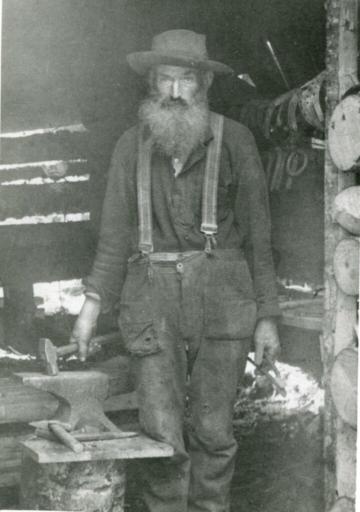
The people living here were subsistence farmers, economically disadvantaged. They came from the stock of Ulster Scots Borderlanders who culturally had made whiskey, and in the US moonshine, as supplemental income for generations. They opposed federal tariffs which benefitted larger industrialists but not small producers. Perhaps this political opposition is part of why they were categorized as being backwards, isolated, uneducated, defiantly law-breaking, and resistant to change from the outside world.
During and after the Civil War, the isolated area attracted army deserters from both sides and opportunists, making it an even more difficult to regulate and enforce laws. Moonshining was prevalent, due to the favorable conditions such as the isolated mountain roads, clean water sources, and affordable land en route to more industrial areas. Some of the most dramatic legends of moonshiners in conflict with lawmen come from this region and time period.
The area was adjacent to the State Highway laid out by South Carolinian Joel Poinsett, built in the 1820s, a bridge named for Poinsett is one of the few remaining indicators of the prominent road that passed through what is now Jones Gap State Park. It connected Greenville, SC to Asheville, NC in its earliest days, though it has been supplanted by more modern roadways over time.
The Dark Corner was disputed in other times as well. During a time known as the “Walton War’ from 1804-1818 boundary demarcation abnormalities left an “orphan strip” of land in this region where it was unclear which state it belonged to. North Carolina, South Carolina, Georgia, and Tennessee. People fought and died over which state had the authority to levy taxes and should be providing services to the residents of the disputed area.
As the railroad lines were built to finally reach this isolated area of southern Appalachia, it changed the parameters that had made a particular culture and economic activity thrive. More and more developers discovered the Dark Corner, and the land disappeared from the hands of locals. Some of the key places during that time in history have since been flooded for watershed access for larger urban areas like Greenville.
The Dark Corner is a sometimes-unknown part of the history of the lands on the border of North and South Carolina that still sparks the imagination of history enthusiasts today. Photographs and information for this column are provided by the Rowell Bosse North Carolina Room, Transylvania County Library. This article was written by Local History Librarian Laura Sperry. Sources available upon request.