
After the Colonial era ended in the United States, the Federalist era began with many developments and initiatives for infrastructure. One feature in the southern Appalachian region during this time was what was known as the “Drover’s Road.”
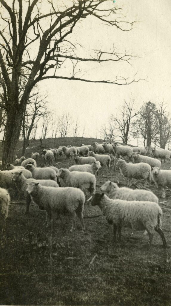
Drovers were a type of herdsmen who assisted with the sale of large numbers of livestock for individual farmers. This type of animal husbandry was common in rural areas, such as how herdsmen from the isolated Welsh countryside would drive their stock to market in the urban centers of the British Isles. Appalachian farmers needed herdsmen who could drive sheep, cattle, turkeys, or pigs to larger markets in cities or ports and be trusted with large amounts of money and credit from the sale and then return for payment.
The drovers would have utilized the help of a few assistants to walk livestock to market at a pace of about 8-10 miles per day. This pace, though slow, was the necessary one to maximize the use of feed. If the pace was too quick, the animals would lose weight along the way and be worth less money at market.
Prior to European settlement in the western North Carolina mountains, there were only foot paths. The rivers were not navigable here in a way that was useful to European commerce, trade, and transportation because of the Eastern Continental Divide. The geological dividing line runs along the Blue Ridge escarpment and marks the turning point for the direction rivers flow – either east to the Atlantic coast, or west to lands yet undiscovered in these early days of settlement.

By 1793 an actual road had been built from Charleston, South Carolina up through the mountains of western North Carolina towards Virginia. The old state road extended all the way to Flat Rock, North Carolina by the early 1800s. This was initially known as The Drover’s Road or Old Stock Road. It was narrow, winding, and not always suitable for carriages and carts, making horseback a very common form of travel.
All regional commerce seemed to be connected to the early Drover’s Road. All along the route, inns and waystations sprang up, as well as a number of services and retail locations to accommodate the needs of the varied travelers to the region. Not unlike the present-day, the road’s travelers and nearby inhabitants were from many walks of life and utilized it for various purposes, including droving livestock, personal and recreational travel, and moving goods and correspondence.

Waystations dotted the way as enterprising locals provided every conceivable service at their locales. It was not uncommon for a waystation to include boarding rooms, camp-style bunk houses, pens for multiple herds of livestock that needed to be kept separate, warehouses for livestock feed and human consumables, grist mills, sawmills, tanneries, blacksmiths, carpenters, post offices, general stores, taverns, distilleries, and toll gates.
The need to feed motivated the creation of large fields of corn and other staples near the waystations, which changed the style of agriculture of the region. It also meant that labor, sometimes from the enslaved, was needed to tend to the crops.
As the Drover’s Road was more and more utilized, it became not only a functional, commercial route, but also one for the recreational tourist. Tourists from wealthy cities would visit to escape the heat and societal expectations of the low country or eastern coast. Some locals entered into the tourism industry to provide lodging, entertainment, and outdoor experiences for elite visitors.

Elite demands for a similar lifestyle to what they were accustomed to in the city led to an unexpected boon for locals; they too could buy merchandise that had been imported from more industrial locations, and the increase in postal usage from tourists writing to loved ones back home often justified the development of more and more post offices, improving the service for local and tourist alike.
By 1824 the influx of drovers and livestock—up to 150,000 animals each month—was such that the state saw the need to transform the route into a more officially maintained route that would be called The Buncombe Turnpike. A state charter was drawn up and funding was found for the endeavor. The route passed through Henderson and Buncombe counties and then veered left towards Tennessee.
Joel Poinsett, a South Carolina politician, headed up efforts to improve and formalize the road. One remnant of his project endures in Table Rock State Park where a Gothic-arch stone bridge is now the only memento of this first official road in the area.
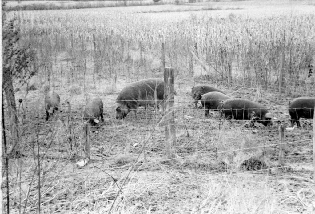
In Transylvania County, the route included the section known locally as the Little River Turnpike. Swine were so commonly driven and housed in this livestock market area near the present-day intersection of Crab Creek and Cascade Lake Roads that a colloquial name for the area was once “Hogtown”. It connected Crab Creek Road to Jones Gap Road.
The Buncombe Turnpike and adjoining routes that had developed out of the Drover’s Road were changed beyond recovery with the 1875 Stock Law. Prior to this law, North Carolina was an open-range state, meaning that livestock farmers were allowed to let their animals roam freely, and the onus of responsibility for crop safety was put on food farmers to fence their crops and prevent destruction by the roaming livestock.
After the law was passed, livestock were required to be fenced, which ended the ease with which drovers could conduct their drives. By the 1880s Asheville had finally been connected to the rest of the state and its neighbors via railroad, and this was essentially the final nail in the coffin for the droving industry. Railcar was a much faster, safer, and economical way to handle livestock sales, thus negating the need for drovers altogether.
The Drover’s Road marked an important development in the region during its earliest settlement by European Americans. Photographs and information for this column are provided by the Rowell Bosse North Carolina Room, Transylvania County Library. This article was written by Local History Librarian Laura Sperry. Sources available upon request.